Check River Flow Before You Go: Family How-To
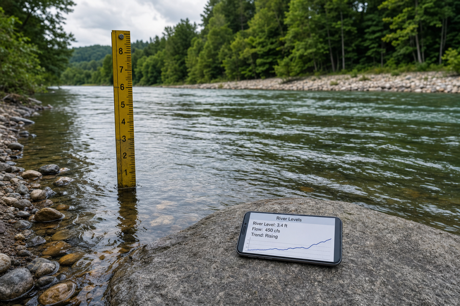
Before you pack swim gear and load up the kids for a river day, knowing the river levels can mean the difference between a fun splash and a risky moment. Swimmers ages 5-12 with grown-ups need clear data—not guessing. Here's how to read a river gauge, use river levels apps, and consult official warning services in the US, UK, and Australia so you can make safe go/no-go calls.
Key Terms: Stage, CFS, Rising vs Falling
“Stage” (also called “gage height”) is the vertical distance of water surface above a fixed point near the riverbed or an arbitrary zero point. It doesn’t directly tell you how fast water is moving or exactly how deep it is at every spot. (usgs.gov)
“Flow” or “discharge” is how much water passes a point in a period of time; in the US, often measured in cubic feet per second (cfs). Flow depends on stage, river width, depth, and how rough the bed is. (usgs.gov)
“Rising” means the stage (or level) is going up—after rain, this often means strong current, possibly dangerous. “Falling” means calmer conditions ahead. Even if stage is “normal”, a river that’s rising fast can be unsafe. Always note the trend. (usgs.gov)
Tools You Can Use Right Now
To check a river’s condition before swimming with your children, here are reliable sources:
- In the US, USGS river gauges provide live stage and discharge data. Lookup by river, date, or area.
- In England and Wales, the Environment Agency’s “Check for Flooding” service shows recent river levels relative to typical ranges—low, normal, high—and provides warnings when needed. (check-for-flooding.service.gov.uk)
- In Australia, the Bureau of Meteorology publishes “Rainfall and River Conditions” as well as flood warnings across states and territories—these include river height alerts, maps, and classification (minor, moderate, etc.). (bom.gov.au)
Many river levels apps now tap directly into USGS, Environment Agency, or BOM data so you can view stage, cfs, rising/falling, alerts, and even forecasts. That keyword “river levels app” is worth searching in your app store.
Making Go/No-Go Decisions with Data
When planning a nature swim day, use data over looks. Here’s a simple decision path based on that data:
- Check the stage: compare current height against “normal” and known warning thresholds for your spot.
- See flow or discharge: if in cfs (or m³/s in metric regions), know what typical flows are for that spot when kids swim safely.
- Look at trend: is the level rising fast? Then skip. Is it falling or steady? Probably safer.
- Check official warnings for your area. If flood or high current warnings are issued—don’t go, even if it looks okay. Lifeguarded sites are always best.
If you want a structured way to help your child progress at home, the 10-Week Plan guides you step by step.
It helps if you know your swimming area in advance—what “normal” looks like there. Once I took my 8-year-old to swim, saw a stage reading that seemed low, but flow was double typical volume after rain upstream. Strong under-current took me by surprise. Might have avoided that with quick data check.
[[ctakid]]
Also, for those learning structured swim plans, after understanding river safety you might pair outdoors with something like the swimy.org “10-Week Plan” to gradually build your kids’ swim skills in safer settings—you’ll feel confident choosing where and when to swim based on both skill and safety. 10-Week Plan
Country-Specific Warning Pages & Data Interpretation
United States – USGS
USGS provides multiple streamgages across rivers, shows stage height and flow rate. They often update every 15 minutes, and their rating curves convert stage to flow. It’s important to note that “stage” and “cfs” are different units and mixing them up can lead you to misjudge risk. (usgs.gov)
When you see a rapidly rising stage or flow figure, avoid getting in. Also, sites near dams or after heavy rain upstream can change quickly. Make sure the gauge is for the same reach of river where you plan to swim—not miles upstream.
UK – Environment Agency
The Environment Agency shows real-time river levels measured every ~15 minutes and updated on flood maps and alerts. Measurements are often relative to “ordnance datum” (sea level) or local bed reference height. Low, normal, high ranges are based on historical data. (check-for-flooding.service.gov.uk)
Don’t trust appearance alone. A river that looks ok can suddenly rise because of rainfall upstream. Check “Check for Flooding” before heading out. If flood warnings are active in your catchment, cancel or move to lifeguarded site.
Australia – Bureau of Meteorology (BoM)
The BoM publishes river height data, rainfall maps, and flood classification. They issue flood watches and warnings when catchments are likely to flood. Their network includes more than 10,000 gauges, many automatic, and many agencies involved in sharing data. (bom.gov.au)
They classify flooding severity—minor, moderate, major—and show forecasted levels alongside current river height. If a site near you is forecasted to rise to “minor” flood in coming hours, best skip swimming. Even for “normal-looking” days, heavy rain upstream may trigger warnings later.
Extra Safety Tips for Spring & Summer River Days
Never rely solely on what the river looks like. After heavy rain—even if days ago—rivers can still be swollen and fast. Avoid swimming where there’s no lifeguard. Choose spots with clean water, gradual entry, no strong current.
Always check apps or websites the morning of your trip and again just before leaving. Rivers change quickly. On steep terrain or narrow valleys, river levels can rise unexpectedly. Teach children to leave immediately if water looks dirty, smells strange, or flow increases suddenly.
Final Word
You can plan safer nature days by using a river levels app, watching USGS river gauge data (or local equivalents), learning terms like “stage,” “cfs”, and monitoring rising/falling trends, and seeing if official flood or river level warning services are active. Armed with that info, you’ll make informed go/no-go swimming decisions instead of relying on looks. Your kids stay safe, and your fun day by the river stays that way.
120+ swimming exercises sorted by age — with video and instructions. Developed by swim instructors, completely free.

120+ swimming exercises sorted by age — with video and instructions. Developed by swim instructors, completely free.